Lecture notes - Belépés
16. Movement detection
Force can affect the motion of bodies. Motions sometimes are not possible, this case (hopefully slight) deformations of the body can occur.
Most typical causes of building movements:
- considerable dead loads of buildings. Soil consolidation may take a long time
- imposed loads can vary in time. e.g. water tower can be full of water or can be almost empty. During a hot day, the water level can change rapidly in time which may cause vertical movements in a few mm in magnitude.
- different type of soils can cause movement or deformation of a building. The typical example is the main building of our university.
- change of temperature can cause significant movement or deformations, see the example as regards "Erzsébet híd" in Budapest.
- excavations close or below a building can cause movements or deformations. e.g. the construction of a metro tunnel or station. Other times field works can be very close to the foundation of a building hence the existing buildings need to be monitored.
Aims of movement detection:
- Detecting the current movements, describe them numerically.
- Pointing out the correlation between the possible reasons and effects. Responsibility. Compensation.
- Forecasting movements. Get information well in advance. Avoid having damages.
- Technological aspects.
- To gain experience about the behaviour, state, strength of a structure. Load tests.
Classical surveying methods are used if
- the number of points is limited (versus photogrammetry)
- the points to measure are accessible during the measurements
- the measurements have to be taken at discrete epoch (versus continues measurements)
- the movement is slow enough. During the measurements, there are no significant movements.
Robot total stations can be used widely in order to develop a monitoring system these days. The total station is controlled by computers, measurements are taken in a fully automatic way. Results are uploaded into on-line databases. Authorized users have access to the results. An automatic alert is sent if necessary.
Settlement monitoring of a building
One of the most frequent job.
Tasks in the design phase:
- plan the position of the measured points. Done by civil engineers.
- establishing the measured and reference points. Done by land surveyors.
- planning the schedule of the measurements. Determination of critical values when special activities are needed to carry out. Done by civil engineers.
- accuracy planning. Done by land surveyors.
The
first measurement need be done before the construction. As its result is going to be the reference values, special care needs to be paid.
Carry out the measurements according to the schedule. Make a report of each campaign.
Content of the documentation:
- plan or map about the location of all the points
- elevations measured at different epoch, settlement values in a table.
- visualization of the settlement values.
- technical description
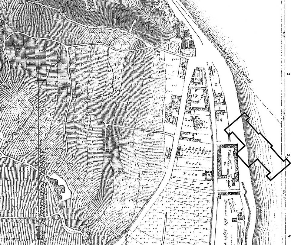
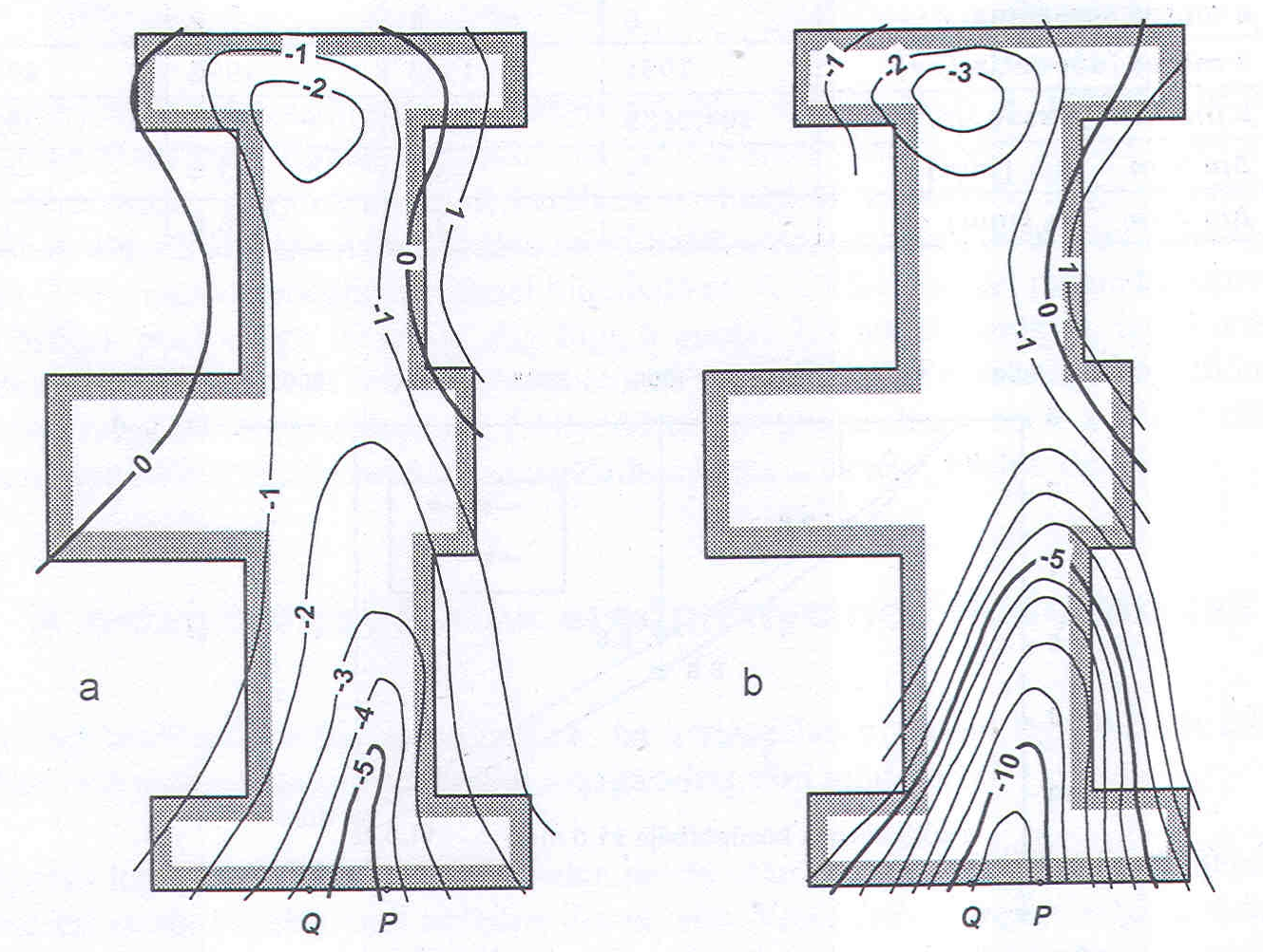
Example of the main building of our university :
The main building depicted in a map made in 1833:
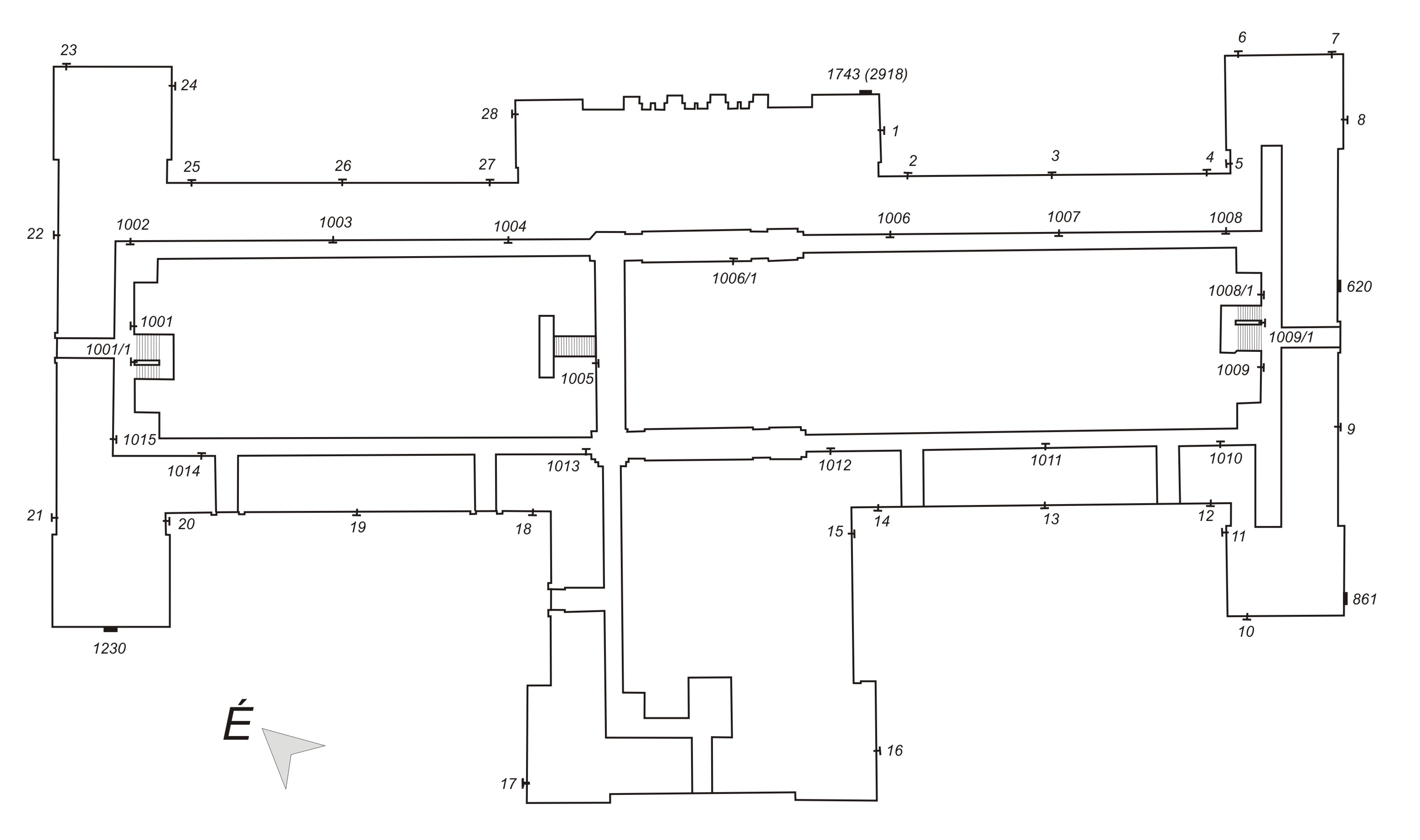
Point to measure on a regular (yearly) basis:
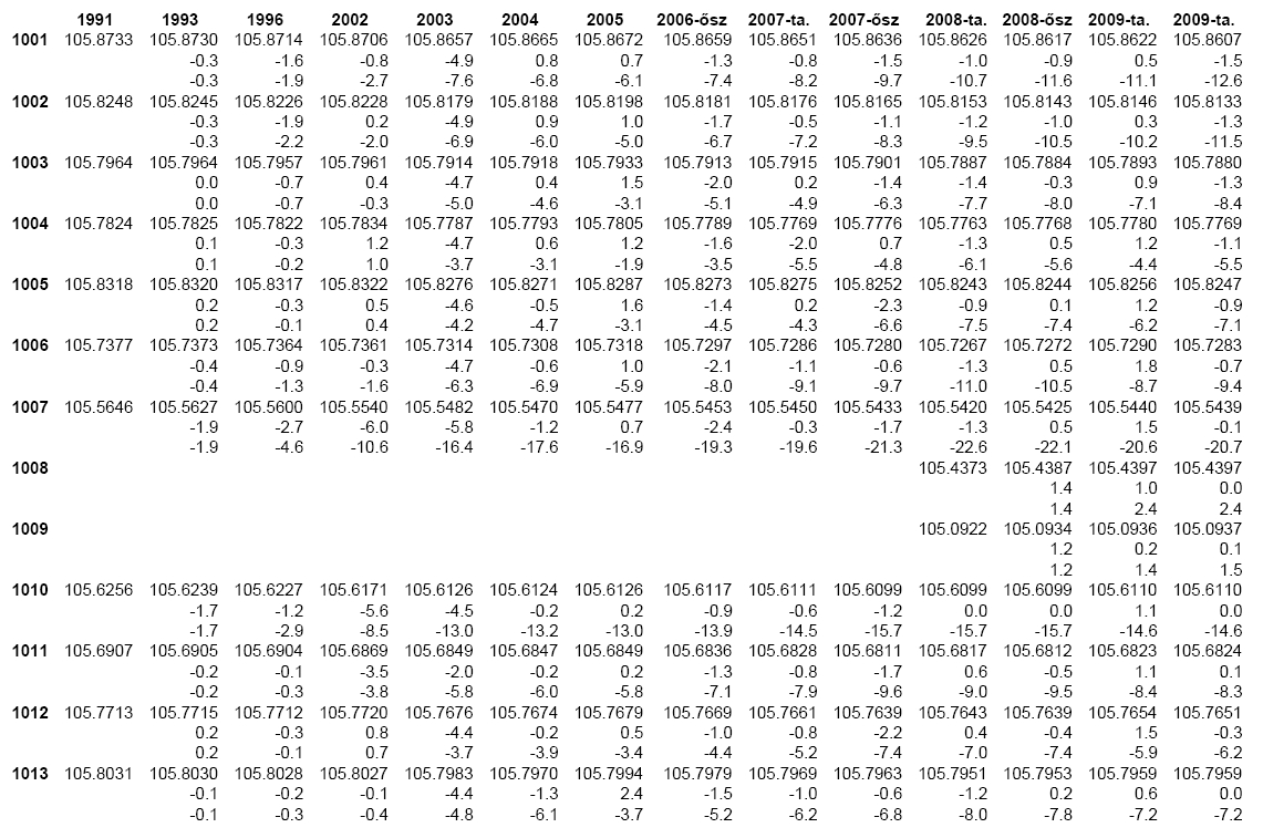
Reduced levels, settlement values in a table:
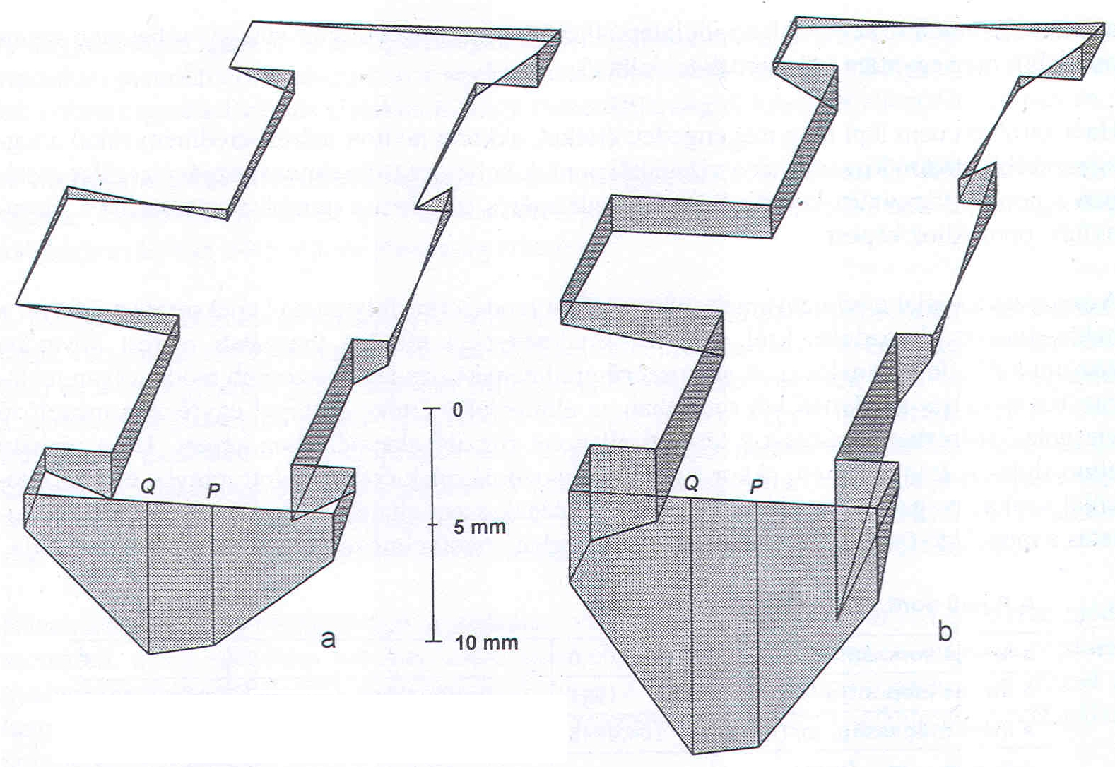
Visualization of settlement values between 1996 and 2001 (a) and between 1991 and 2001 (b). The 1st example:
and the 2nd example:
The 3rd example on a simple time versus settlement values figure: