Lecture notes
Lecture notes - Log in
15. Geometric quality control of constructions
Site Inspectors are also known as Site Supervisors, or Building Quality Officers. They monitor the work of contractors. They main responsibility is to make sure that work is carried out to the client's standards, specification and schedule.
Geometric quality control can be carried out by the site inspectors as well. They typically use basic tools, like tapes, laser beams, spirit levels.
For more complex geometric quality control land surveying techniques are required. First case the land surveyor is hired by the contractor, to put it another way, the same person checks the quality who did the setting out works. Another solution is that land surveyor is hired by the site inspector, therefore an independent land surveyor completes the job.
- control of elevations. Is the slab horizontal? Is it at the designed level? Is the road as slope as it is planned?
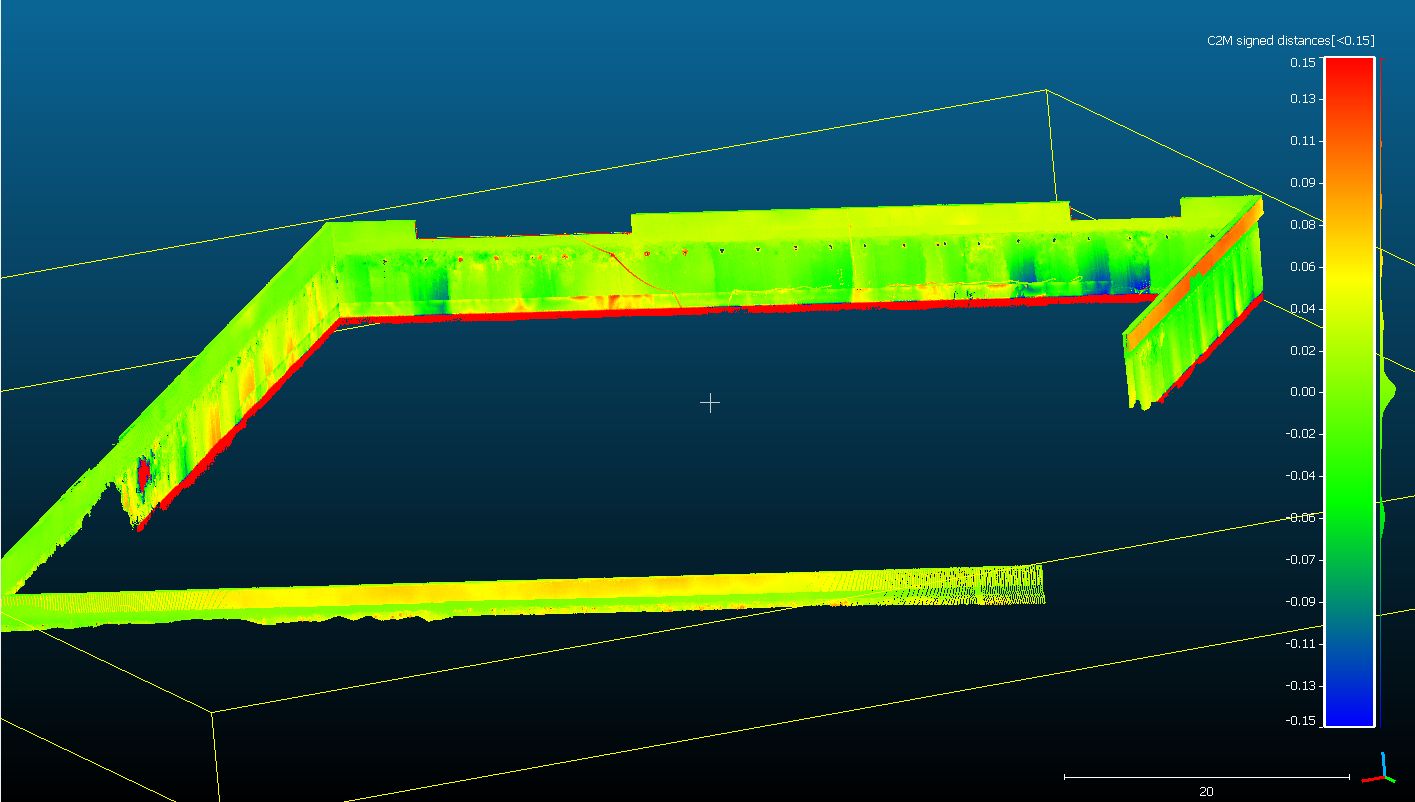
- control of flatness, eg. an existing wall. Is it vertical? Is it flat? Inspection measurements can be done using a robotic total station or terrestrial laser scanner.
- control of dimensions. Is the reinforced concrete pillars as width as it is planned? Is its shape as it is planned, for instance in case of circular reinforced concrete pillars.
- control of
positions. Is the pillar in its designed position? Do the reinforced concrete pillars at different levels in a building have any offset?
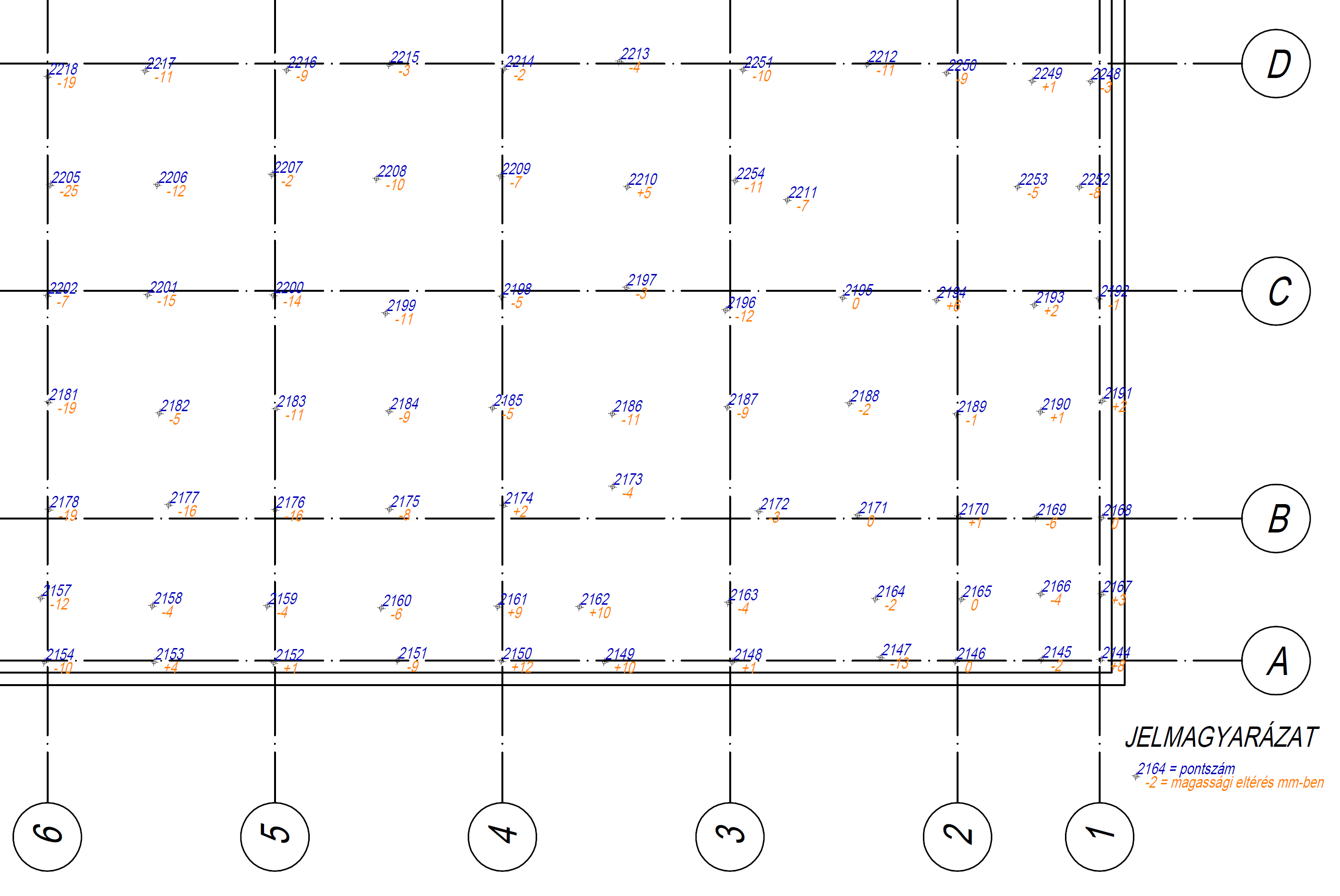
1st example: slab
Is it horizontal? Is it on the designed level?
Height differences in points measured by a total station: (blue: point id, orange: height difference in mm)
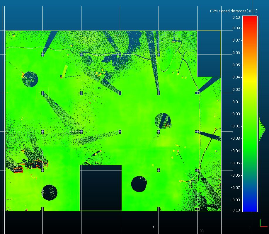
Point cloud, colourized by the height difference from the designed level
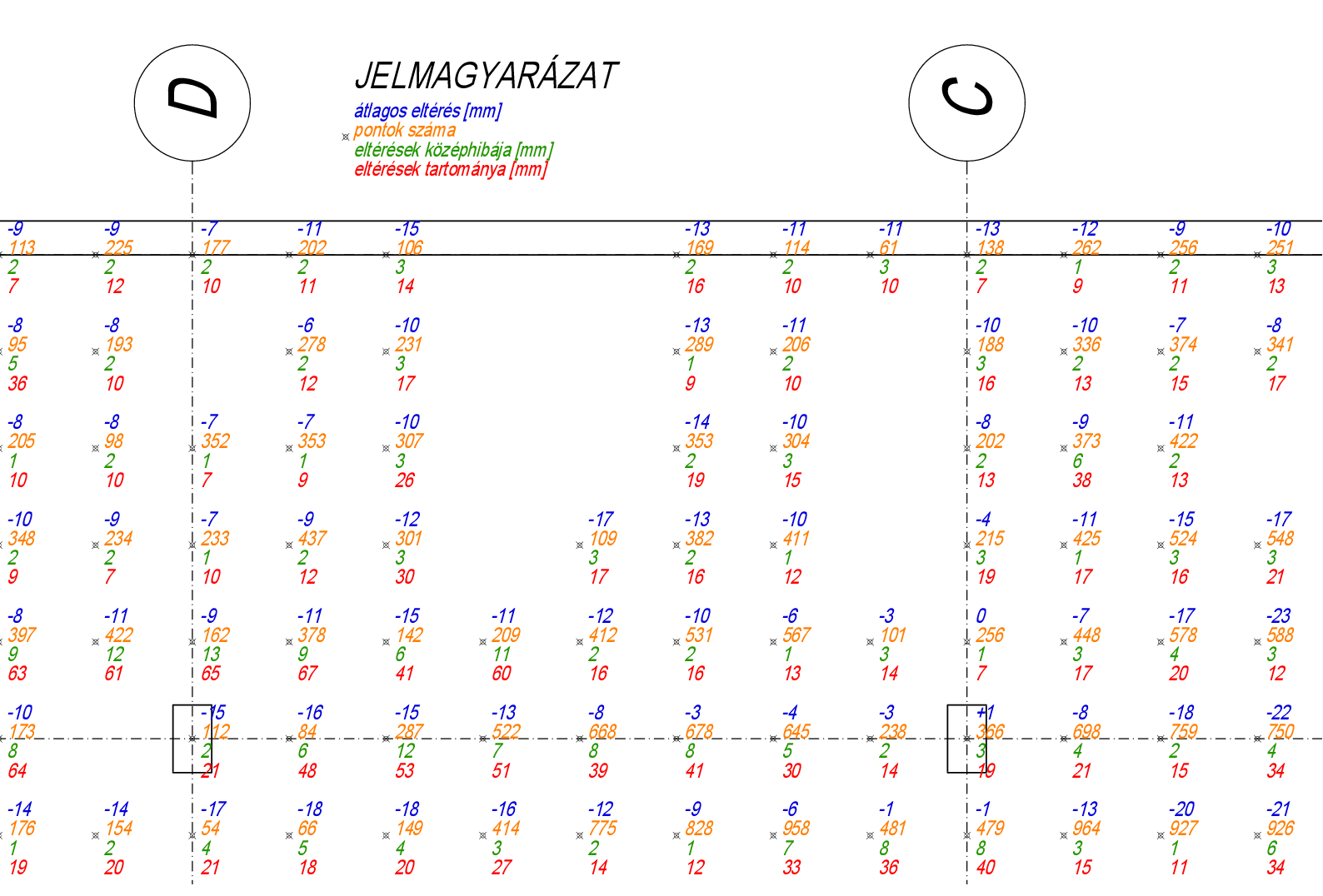
The height difference between the designed and actual geometry, expressed in millimetre and given in a grid with some statistics (mean - blue, number of points in the grid - orange, standard deviation - green, range - red)
2nd example: diaphragm wall
Is it vertical? Is it flat? Is it in its designed position?
Photo:
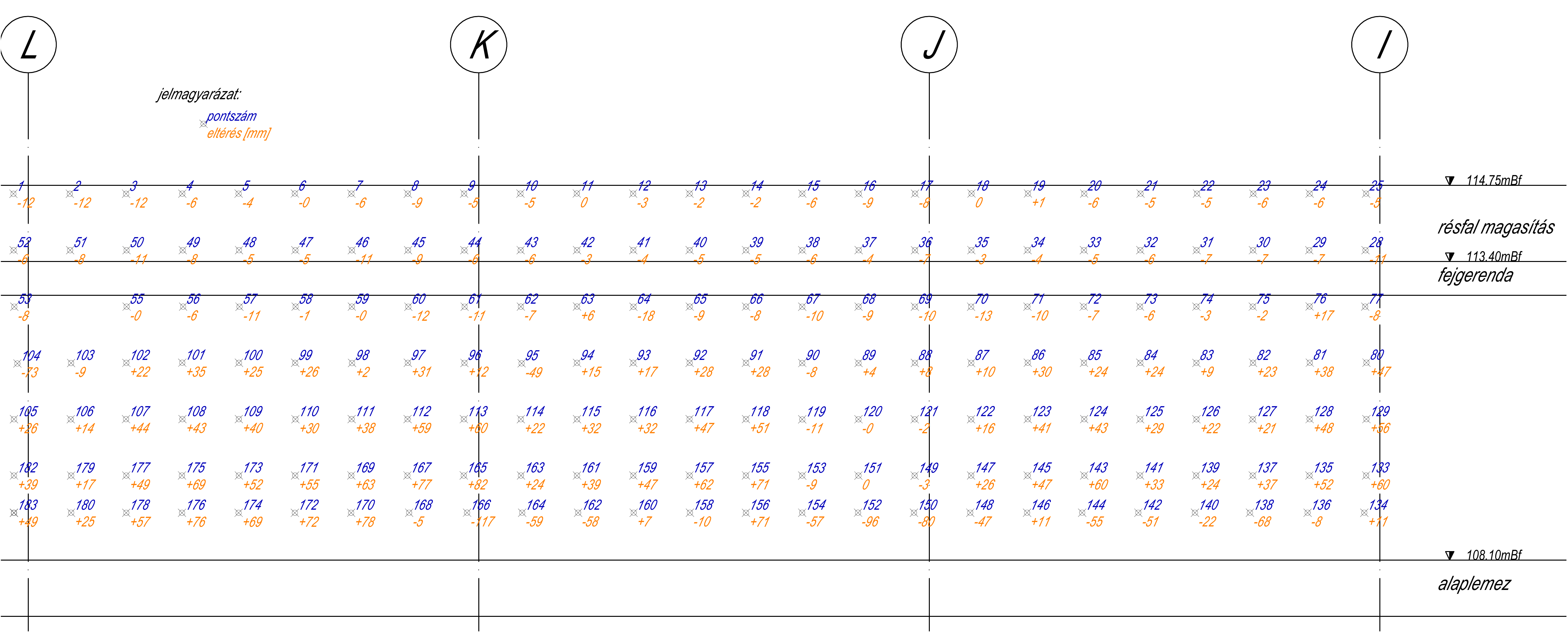
Points, point ids and alignment errors on a panoramic image. Measurements are done using a robotic total station.

The same information in front view:
Point cloud measured by a terrestrial laser scanner. The point cloud is colourized by alignment error.
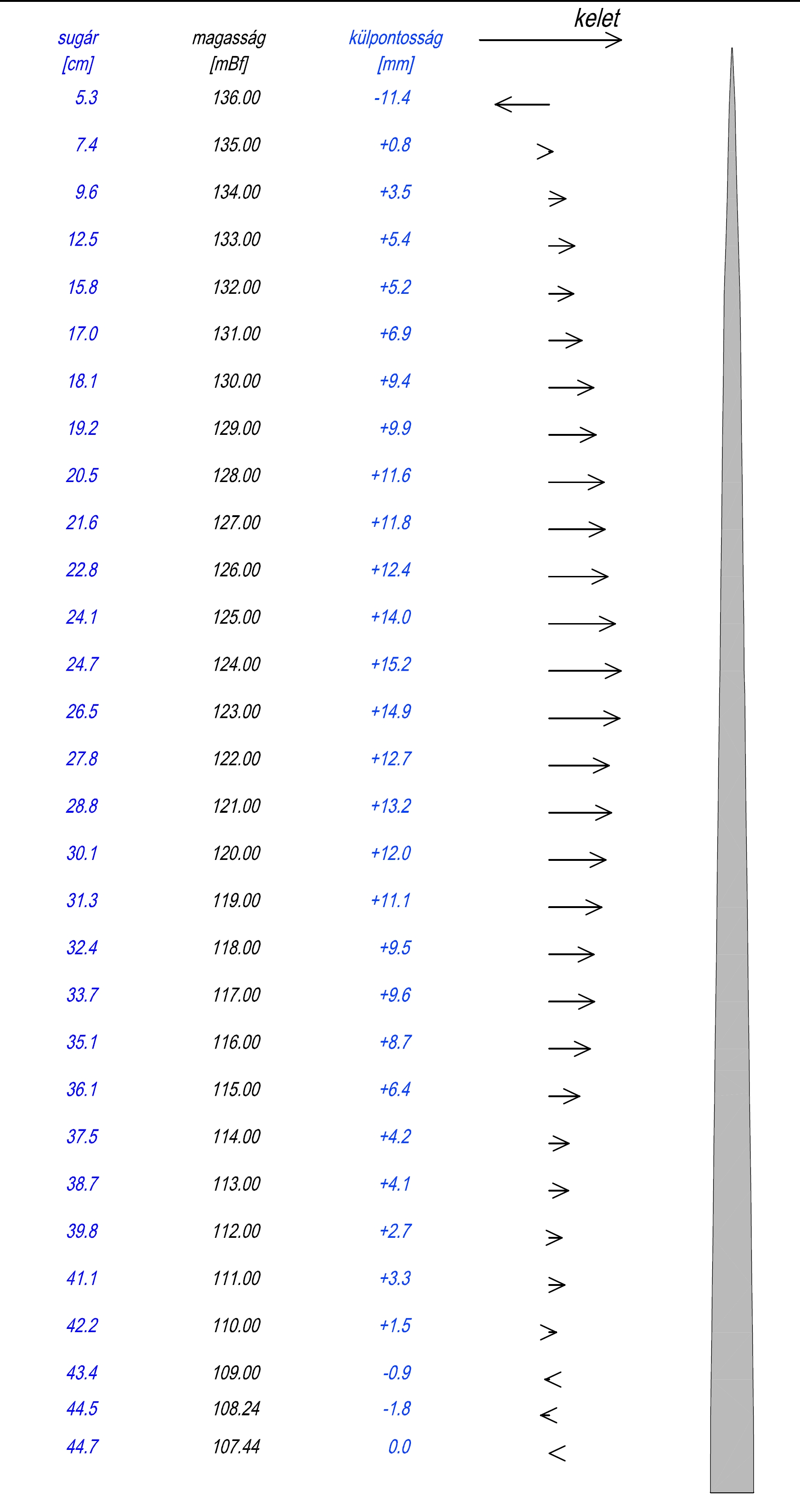
3rd example: National flagpole
Is it vertical or not? Is there any offset between the elements?
Radius [cm], elevation [m], offset [mm] values in east-west section view
