Lecture notes
Lecture notes - Belépés
3. Map projections
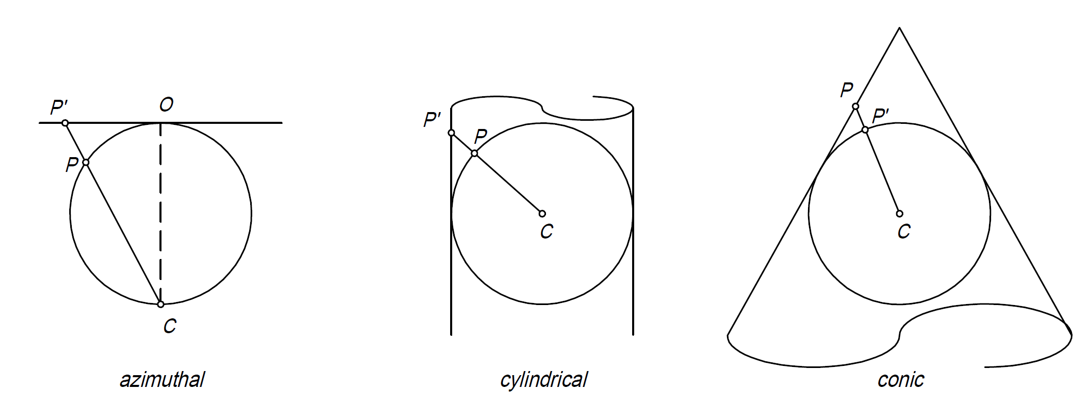
Projection always involves distortions because the spherical surface of the Earth cannot be unfolded onto a plane without creases and ruptures. In geodesy, projection methods are employed where the distortions remain within certain limits. The projections in geodesy are always conformal, and the general objective is to ensure that the length distortion (scale factor) does not exceed a value of 1:10,000, i.e., 10 cm per 1 km. Great majority of the countries use national map projections, in Hungary the official and national map projection is abbreviated as EOV. The Hungarian EOV map projection is an oblique, secant cylindrical projection.
It is worth noting that the abovementioned general objective regarding the maximum scale factor has been achieved just for 95% area of the country with Hungarian EOV and the maximum length distortion value is +26 cm per 1 km. These values are acceptable in the engineering practice.Further important map projections:
- Web Mercator
- UTM
Web Mercator
- used by all major web map providers: Google, Bing, OSM ...
- simple formulas and calculation
- meridians are equally spaced vertical lines
- applicable for global and local areas as well
- relatively large distortions, especially near the poles
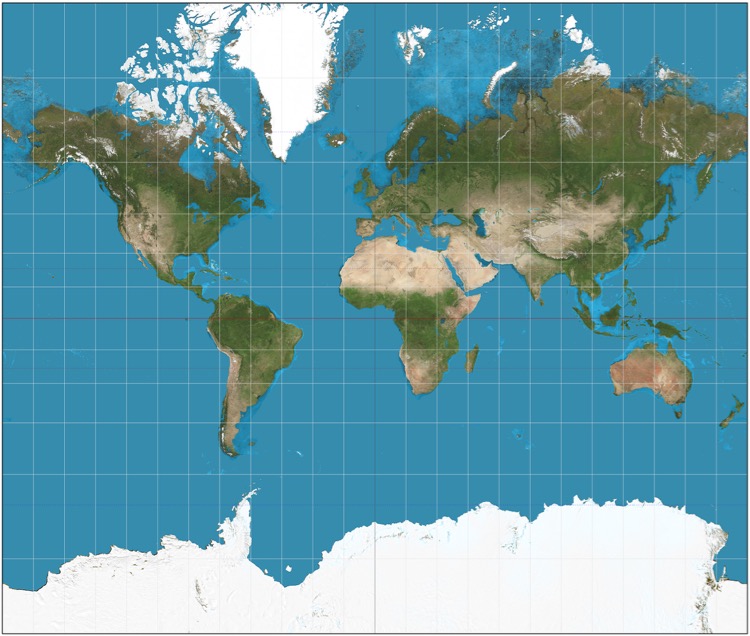
source: https://www.atlasandboots.com/map-projections/#gallery-7
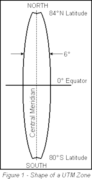
UTM: Universal Transverse Mercator
- 60 zones, each of them has 6 degrees of longitude in width
- the cylinder intersects the ellipsoid, the scale factor at the central meridian is 0.9996
- false easting and northing
- WGS84 ellipsoid
- NATO's official map projection
- one map projection for the whole globe with relatively small distortions
- a wide range of countries applies as a national map projection
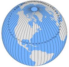
source: https://gisgeography.com/wp-content/uploads/2016/05/UTM-Zones-Globe-2-300x291.png